JamLegend Trailer from JamLegend on Vimeo.
Thursday, August 28, 2008
Jam Legend
JamLegend Trailer from JamLegend on Vimeo.
Answers.com
- pick a Answers.com badge
- enter your name, e-mail and URL
- grab the code
WiZiQ
Blabberize
I have been a delinquent blogger but a full-scale kitchen remodeling project has kept me occupied for the past month. The plumber is here as I type and I hope to have running water in the kitchen sink by the end of the day. Enough about my remodeling tales of misery...let's get on to Blabberize.
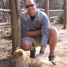
Blabberize is one of those tools that could be categorized as mostly made for fun but with some educational potential. The concept is very basic. You pick a picture of a person, animal, robot or any other organism with a mouth, record a message and then Blabberize makes the mouth move in your picture to say your recorded message. It's similar to Voki but you are able to upload a picture of yourself rather than just creating an animated avatar. They don't have an education only version yet so you can run in to some less than appropriate content on the site so beware. I have included a sample that hits home and seemed perfect for a blog about educational technology.
Blabberize is one of those tools that could be categorized as mostly made for fun but with some educational potential. The concept is very basic. You pick a picture of a person, animal, robot or any other organism with a mouth, record a message and then Blabberize makes the mouth move in your picture to say your recorded message. It's similar to Voki but you are able to upload a picture of yourself rather than just creating an animated avatar. They don't have an education only version yet so you can run in to some less than appropriate content on the site so beware. I have included a sample that hits home and seemed perfect for a blog about educational technology.
Sunday, August 10, 2008
Mapness!
 Mapness is a travel journal tool that allows you to map out a trip and post pictures, video and text-based comments/descriptions along your route. Obviously, one way to use this would be to map out a trip that you have taken complete with pictures and videos you collected along the way. But for the k-12 classroom that particular application might not work so well since most teachers aren't taking too many trips with their students. However, you could use Mapness to map out trips of historical figures (Lewis and Clark come immediately to mind), historical events (the movement of the Union or Confederate army during the Civil War) or even the travels of fictional characters from a book your students might be reading. At this point, Mapness is still in beta so I'm guessing there may be some more features coming down the road, such as the ability to embed your travel map, but for now it seems to be fairly handy. It's a lot like using Google Maps with Picasa Web Album to plot out things on a map but the interface is more structured and geared towards mapping out a particular route rather than just geotagging images, videos and text on a map. You can share your travel map by giving others the link and it is currently free to sign-up and use.
Friday, August 8, 2008
Lego Universe
 I'm breaking just about every one of my rules in regards to what resources I choose to share on this blog by writing about Lego Universe. First of all, it isn't free (or at least it won't be once it is out of Beta testing). They are planning on providing it on a subscription basis. It is billed as a game rather than an educational tool. They are classifying it as a MMOG (Massively Multiplayer Online Game). And the icing on the cake is that it will run on PCs only and I'm a Mac man. Why then, you may be asking yourself, am I sharing this with all of you? Because I am a Lego maniac and have been ever since I was 5 years old and received my first Lego set from my grandparents for Christmas. I have gotten a set of Legos for Christmas every year since then, I'm 38 now, and I still enjoy playing, building and creating. My daughters are particularly happy when I share with them. Keep an eye on the Lego Universe. It may just be one of those tools that you can utilize that allows you to take advantage of your students' motivation and engagement to achieve some curricular goals.
Subscribe to:
Posts (Atom)